Good day LVM Track clients and partners. This month you will find updates to both functionality as well as the interface for ongoing improvements to the user experience. New and exciting enhancements will continue to be released on a regular basis, so keep an eye out for our Newsletter every month!
New filtration criteria in the Access tab
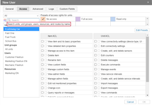
New filtration criteria have been added within the Access tab to search for objects and filter through results faster. You can search and filter by: Unit, Unit groups, Users, Resources, and Routes. Additionally, you can also search by Creator, Account Name, and Unit ID. This is especially useful when trying to change access to a group of units from a different resource or group in bulk (once you have filtered the right group of units, simply mass select and apply the desired access levels to all).
A new tooltip has also been added when hovering over the Search box to assist users.
Date range selector added to Dashboard (Monitoring)
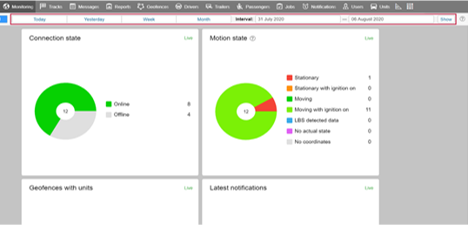
Users can modify the date range for data that is displayed on the Dashboard within the Monitoring section.
Prior to this update, the Dashboard presented data for the last seven days, as a quick reference tool.
Users can now either select one of the pre-set period buttons (Today, Yesterday, Week, and Month), or they can use the date range selection by specifying a particular date range using the calendar which will open upon click on the either start or end date boxes (see screenshot).
Interface Improvements
The following sections have received visual improvements/enhancements:
- Top Navigation Panel
- Work List (Monitoring)
- Bottom Information Panel
- Dialog Boxes
- Out-of-blocks Area
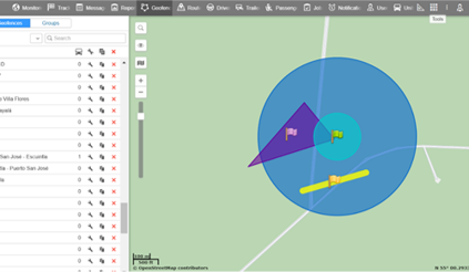
Geofence Sorting
Improvements have been made to display and sorting of geofences while rendering.
Normally Geofences are rendered in no display order. In situations where an account has a very large of geofences, or many small geofences nested within larger geofences it would be more difficult to visually separate them.
The new update ensures these geofences (in those scenarios) are easy to identify on the map.
The display sorting order is as follows: Large circle type geofences and polygon type geofences are sorted smaller geofences; line type geofences are always on top of other geofences.
Immediate geofence display after they are created*
In order to see a new geofence on the map, you needed to display the geofence in the list after creating. Now it has become easier and faster when creating a geofence because it is automatically displayed on the map after creating a geofence from the interface.
*Note: this does not apply to imported geofences.
New WebGIS Map layers
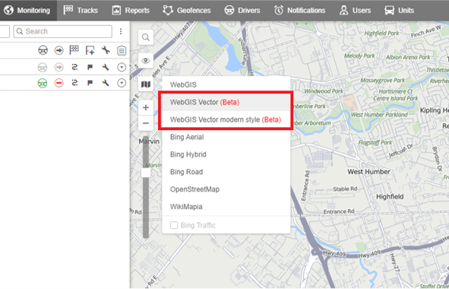
Two new Map Layers have been added to the Map selector, both are vector maps.
- WebGIS Vector looks similar to the current style of WebGIS
- WebGIS Vector Modern Design is a visually updated variant
Aside from esthetics, the new vector maps are more technologically advanced than previous map layers. They load faster and will allow adding new enhanced features in the future.
Product Feature of the Month
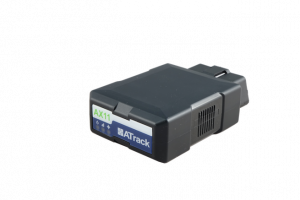
“ATrack AX11 Plug and Play OBDII GPS Tracker”
The ATrack AX11 comes in the industries most popular form factor for light and medium duty vehicles. It’s a plug and play device, which does not require professional installation.
Fully compatible with next Generation networks, this 4G LTE-M based device provides excellent quality tracking data, including engine data, fault codes, and fuel management data for modern vehicles.
With optional Bluetooth Low Energy accessories, businesses can facilitate wireless driver ID, Tire Pressure Monitoring solutions, and more.
Feature Highlights
- 4G LTE-M
- Driver Behavior Monitoring
- Engine Data
- BLE Accessories – Driver ID, TMPS, etc.
- High Quality Tracker
- Excellent GPS performance
- Audible Unplug Alert (Including Notifications to Management)
- Optional Y-Cable to Hide the modem
- No installation required
Contact us
Contact us today for more information, pricing, and specific case studies.
Tel: 1-800-964-4551
Email: info@lvmtech.com

